
The Transparent Network for Earth’s Well-Being.
EarthMesh is an open-source environmental intelligence platform built to bring real-time transparency, predictive insight, and community resilience to the world’s changing ecosystems. Designed as The Transparent Network for Earth’s Well-Being, EarthMesh combines distributed sensor networks, AI-powered analytics, and open public dashboards to monitor environmental conditions across cities, coastlines, rivers, forests, farms, and neighborhoods. Its mission is to make critical environmental data accessible, understandable, and actionable for governments, researchers, emergency responders, and everyday communities.
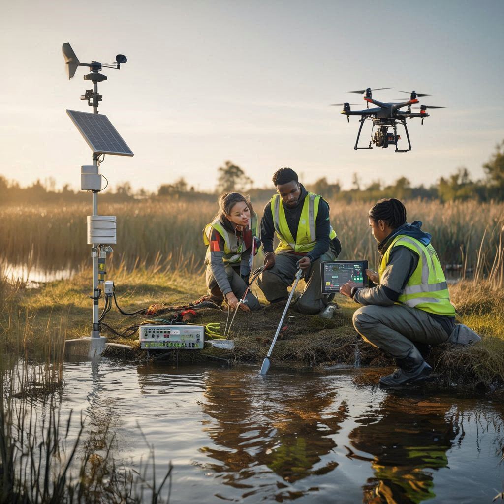
At its core, EarthMesh supports a wide range of environmental sensing capabilities. The platform can track air quality using particulate and gas sensors for PM2.5, PM10, CO₂, NO₂, ozone, and volatile compounds. It also monitors water quality through pH, turbidity, contamination, dissolved oxygen, and river-level sensors, helping communities detect pollution events or flood risks early. Weather stations and rainfall gauges provide real-time climate data such as temperature, humidity, precipitation, and pressure, while optional modules can measure soil moisture, heat index, and noise pollution. These sensors can operate through LoRaWAN, Wi-Fi, mesh networks, or cellular IoT, with solar-powered off-grid deployments for remote areas.
What sets EarthMesh apart is its AI analytics engine, which transforms raw sensor readings into meaningful predictions and alerts. Machine learning models can detect anomalies like sudden pollution spikes, dangerous water contamination, or rapidly rising flood levels before they escalate into crises. Predictive forecasting tools estimate air quality trends, flood probabilities, heat waves, and environmental stress patterns hours or days in advance. By combining local sensor data with satellite imagery, weather forecasts, and drone mapping, EarthMesh creates a richer picture of environmental risk and resilience than traditional monitoring systems.
EarthMesh is also built around public transparency and open science. Its web dashboards display live environmental maps, neighborhood-level conditions, hazard alerts, and historical trends in a clear visual format. Open APIs allow developers, researchers, and schools to access environmental data for studies, applications, or civic innovation. Communities can participate through citizen science tools, reporting pollution events or adding locally managed sensors to expand the network. This open-source model ensures that environmental monitoring is not hidden behind proprietary systems or inaccessible institutions.
For smart cities and emergency preparedness, EarthMesh offers advanced integrations such as automated flood warnings, drainage system monitoring, traffic-related pollution analysis, evacuation route intelligence, and renewable energy coordination. It can also support biodiversity protection through wildlife acoustics, habitat monitoring, and forest health sensors. Whether deployed in a single town or scaled globally, EarthMesh provides a modern, transparent infrastructure for protecting ecosystems, improving public health, and helping societies adapt to environmental change through data-driven action.
- Earthmesh – Environmental intelligence platform monitoring air, water, soil, noise, and flood conditions in real-time with predictive analytics. AGPLv3